Update: the storm has moved well inland and weakened — the clinic is open Wednesday, September 2 at normal hours. The flash flood risk remains active through Wednesday evening, so please use caution traveling. This page is not a substitute for official alerts — see the links at the bottom for live NHC and NWS products.
Edouard is now inland and weakening — expected to become a tropical depression tonight and dissipate by Wednesday night. Direct wind/surge threat to Beaumont has passed.
Flash Flood / Flood Watch still in effect — Port Arthur to Beaumont corridor, through Wednesday evening
Staff surveyed the route to the clinic this evening: debris and a downed tree on a power line along the way, though cleanup crews and Entergy line crews were actively on scene working through it. This is one team's observation on one route, not an official report — please still check DriveTexas.org above for your own route before heading in.
Special thanks to Tim Richardson and the Tropical Storm Central (TSC) team, whose local storm tracking helped inform this page. Consider subscribing to TSC for active, informed opinion on storm coverage.
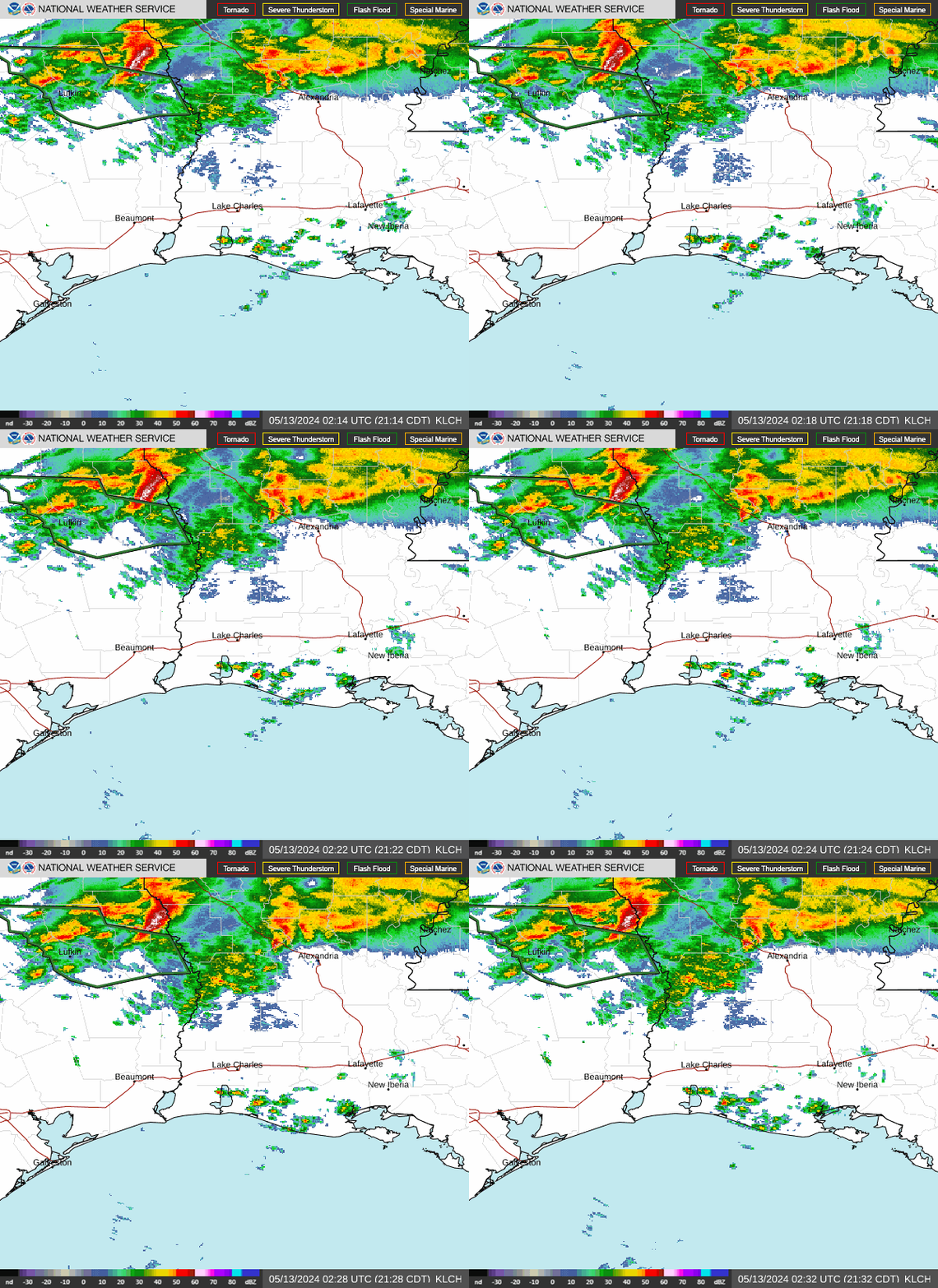
Live radar
This loop updates automatically every few minutes, straight from the National Weather Service — no need to refresh the page.
Live radar loop — Lake Charles (KLCH), the nearest radar to Beaumont. Source: National Weather Service.
Where the storm stands
Edouard made landfall in southwestern Cameron Parish, LA as a 50 mph tropical storm Tuesday afternoon and is now well inland. Per the 4:00 PM CDT advisory, the storm is weakening quickly and is expected to become a tropical depression tonight and dissipate by Wednesday night. Heavy rain and flash flooding remain the primary ongoing threat as it tracks inland.
As of 4:00 PM CDT (Advisory 6)
Winds 50 mph
Landfall
Tuesday afternoon
Landfall location
SW Cameron Parish, LA
Expected dissipation
Wednesday night
Local flood warnings
With the wind/surge threat passed, this local map is being updated to show current flood watches and warnings for the Beaumont/Port Arthur area rather than the earlier hurricane watch zones.
Updated flood warnings map — pending refresh from weather.gov/hgx
Placeholder — replacing the earlier hurricane watch map, which is no longer current.
Rainfall & flooding
Rainfall so far (Jefferson County)
~2–5 in
Additional rain possible
3–5 in
Elevated flood risk through
Wed. evening
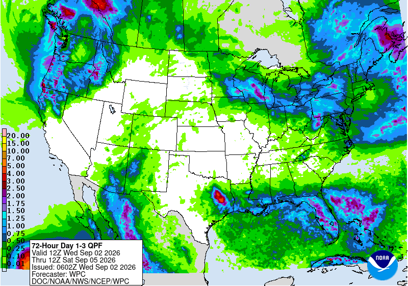
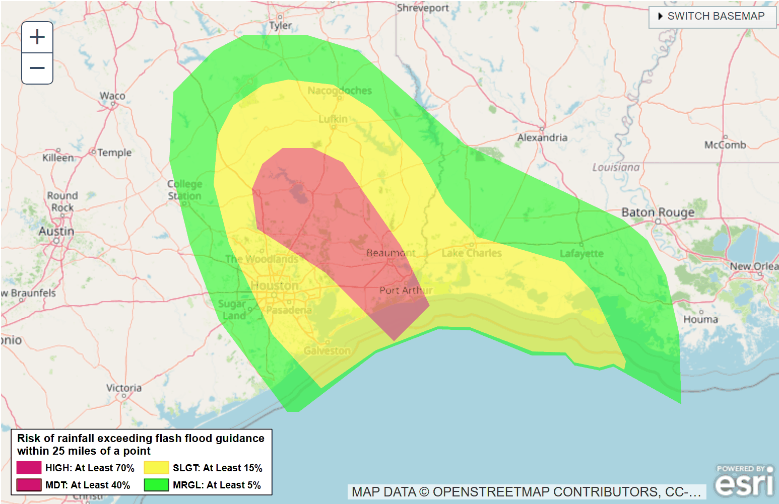
The rain threat was upgraded midday. The Weather Prediction Center raised the Beaumont/Port Arthur corridor to a Moderate Risk (Level 3 of 4) for excessive rainfall, citing likely urban flash flooding with rainfall rates of 2–3 inches per hour. A Slight Risk (Level 2 of 4) surrounds that zone across the wider southeast Texas / southwest Louisiana area, continuing into Wednesday for part of the region.
This is no longer just a landfall-day event. Models are consistently flagging the same general region for repeated, slow-moving thunderstorms through Wednesday into Thursday — the concern is "training," where storm after storm crosses the same spot, allowing rain to pile up fast even in areas that don't see the highest single-storm totals. High-resolution models range widely on the peak number, but the more important signal is that multiple independent models keep converging on the same corridor.
WHAT THIS MEANS FOR BEAUMONT
Roughly 2–5 inches has already fallen locally, with another 3–5 inches possible before the flood watch is expected to expire Wednesday evening. Don't fixate on any single high-end model number — the reliable part of this forecast is the region, not the exact total. Expect the flash flood risk to remain elevated through Wednesday evening, with the potential for fast-rising water on streets, creeks, and bayous if storms stall or repeat over the same area.
Excessive rainfall / flash flood risk outlook, day 1–3 (shown before the midday Moderate Risk upgrade for the Beaumont/Port Arthur corridor). Source: NOAA / NWS / Weather Prediction Center.
Wind
The wind threat has passed. Gusty tropical-storm-force winds accompanied landfall and Edouard's initial push inland, but the storm is weakening quickly and winds have already dropped off across the Beaumont area. Rain, not wind, is the remaining concern.
Power outages & restoration
Entergy Texas posted a detailed update at 12:30 PM Wednesday, 9/2. Crews restored power to roughly 25,000 customers overnight; about 48,200 remain without power across the service area, down from a peak of ~80,000 on Tuesday. Entergy expects at least 50% of all impacted customers restored by the end of day Wednesday, with hardest-hit areas taking longer.
Restoration estimate not yet posted for this network · damage assessment 30% complete
6 poles down · ~6,750 ft of downed wire · 1 damaged transformer · 5 damaged crossarms
WHAT THIS MEANS FOR YOUR APPOINTMENT
Our clinic's own power is back on. But if you personally are still without power at home, especially in the Beaumont or Silsbee network areas, full restoration may take until late this week — please don't let that stop you from coming in if you're otherwise able to travel safely.
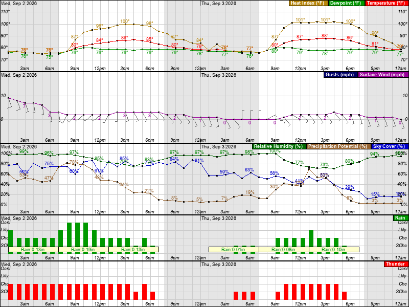
A closer look at what the next two days actually feel like here: temperature, wind gusts, and rain chances hour by hour. Wind gusts are expected to stay in the 15–20 mph range locally — well below the stronger gusts possible right at the coast.
Hourly forecast graph, point location 5 mi W of Beaumont, TX. Source: National Weather Service.
Page last updated Wednesday, September 2, 2026 — early afternoon (power restoration figures per Entergy Texas's 12:30 PM update). Advisories update roughly every 3 hours; please check the official links above for the most current information.